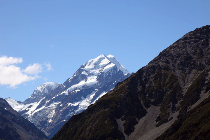
“Aoraki” means “Cloud in the Sky” and was the most spiritual place we went to in all of NZ. It was held as one of the most sacred sites of the Aboriginal people. Having seen it from the air two days earlier, and landed on its snow bank, we knew we had to stay in Aoraki/Cook National park – home to the biggest and best of New Zealand's glaciers - two thirds of southern Alps ice are found here.
The mountains surrounding us were breathtaking. Here is a description of this 12,349 feet high mountain from Haast in 1862: "The magnificent pyramid of Mount Cook… stood high above all, towering into the sky. As far as the eye could reach, everywhere snow and ice and rock appeared around us and in such gigantic proportions that I sometimes thought I was dreaming, and instead of being in New Zealand I found myself in the Arctic or Antarctic Mountain regions."
Aside from gazing up, we also focused on the Tasman River which is the alpine braided river we had previously photographed from the air lying between he Tasman Lake and Lake Pukaki in the distance.
We flew over the same bridge across the Hooker river get which was the result of outflow from the Hooker and Mueller glaciers (right next to Cook) that we then drove across for our first trek.
The first climb brought us to a high vantage point,
which had a wonderful display educating the public about climate change:
We walked to three different viewpoints to see the Tasman runoff that we had first spied from the air.
The water’s chalky white gray green color was magical to observe with a few floating icebergs scattered throughout.
It was our last connection with the natural world before heading to Christchurch and fro there Austraila by way of Tasmania to see MONA in Hobart..


